Salt air, calm bays, and quick Gulf access make Nokomis a boater’s sweet spot. If you’re dreaming about sunrise runs, sandbar stops, or an easy launch for inshore fishing, you’re in good company. The area offers public ramps, nearby marinas, and dry storage that fit different boats and budgets. In this guide, you’ll learn where to launch, how to plan around tides and bridges, and what to know about storage, fees, and safety so your days on the water stay smooth. Let’s dive in.
Know the waterways
Nokomis sits between Sarasota and Venice, with protected inshore waters and quick passes to the Gulf. To the north, you can explore Little Sarasota Bay and Roberts Bay, then continue toward downtown Sarasota. To the south, Lemon Bay and the estuarine waters around Casey Key offer calmer routes for shallow-draft boats. The Intracoastal Waterway runs along the coast and keeps you in sheltered water for longer trips.
Venice Inlet and nearby passes provide Gulf access, but they are affected by tides and currents. Check tides and channels before you go. Use NOAA nautical charts and NOAA tides and currents for soundings, bridge clearances, and timing. For any changes to aids to navigation or temporary hazards, review the U.S. Coast Guard Local Notice to Mariners before departure.
Public ramps to launch
Public ramps around Nokomis and Venice help you reach both the bays and the Gulf. Fees, hours, and trailer parking can change seasonally, so plan to verify details before you go.
Nokomis Beach Park ramp
For many Nokomis residents, the public ramp at Nokomis Beach Park is the closest launch to Little Sarasota Bay and the routes toward nearby passes. Weekend mornings and winter season are busy. Confirm parking rules and any launch fees with Sarasota County Parks & Recreation before you head out.
Venice ramps for Gulf access
Ramps in the Venice area are popular with boaters who want direct proximity to Venice Inlet for Gulf trips and deeper water. Expect tidal currents and variable conditions near the inlet. For current operating details and park information, check the City of Venice Parks & Recreation page.
Northbound options toward Sarasota
If you’re aiming for Roberts Bay, Siesta Key, or Sarasota Bay, consider ramps on the north side of Nokomis. They can save time if your day’s plan is more inshore cruising than Gulf fishing. For availability, hours, and any seasonal limits, verify with Sarasota County Parks & Recreation.
What to check before you launch
- Hours of operation and seasonal closures.
- Launch or parking fees, and whether a resident decal applies.
- Trailer parking capacity and any time limits.
- Low-tide depth at the ramp approach for your draft.
- Nearby restrooms, pump-out availability, and the closest fuel dock.
- Any posted no-wake or manatee protection zones along your route.
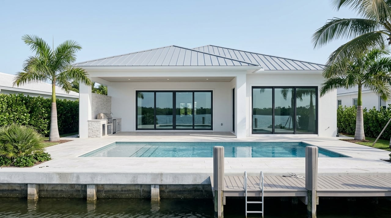
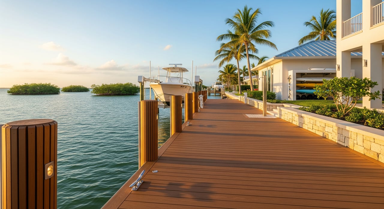
Marinas and services
Marinas near Nokomis range from small bayside facilities to full-service options farther north in Sarasota or south around Venice. Bayfront marinas are often more sheltered for day boats, while ICW locations are handy for longer runs.
Where marinas cluster
- Downtown Sarasota: Full-service marinas with transient slips, fuel, dining, and access to Sarasota Bay. Handy for day trips north.
- Venice and ICW corridor: Convenient to the inlet for Gulf access, common for fishing trips and transients moving along the coast.
- Local community marinas: Smaller facilities near Nokomis and Casey Key can be a good fit for seasonal slip rentals or basic maintenance.
What to ask before you book
- Slip type and rates: transient nightly vs. monthly or seasonal.
- Utilities at the slip: 30A or 50A shore power, potable water, Wi-Fi.
- Services: fuel, pump-out, marine store, haul-out and repair capabilities.
- Security and policies: gated access, cameras, insurance requirements, and cancellation rules.
Environmental credentials
If eco-friendly operations matter to you, ask whether a marina participates in the state’s Clean Marina program. You can learn about the program through the Florida Department of Environmental Protection’s Clean Marina overview. Pump-outs and proper waste handling protect manatees and seagrass and help you avoid citations.
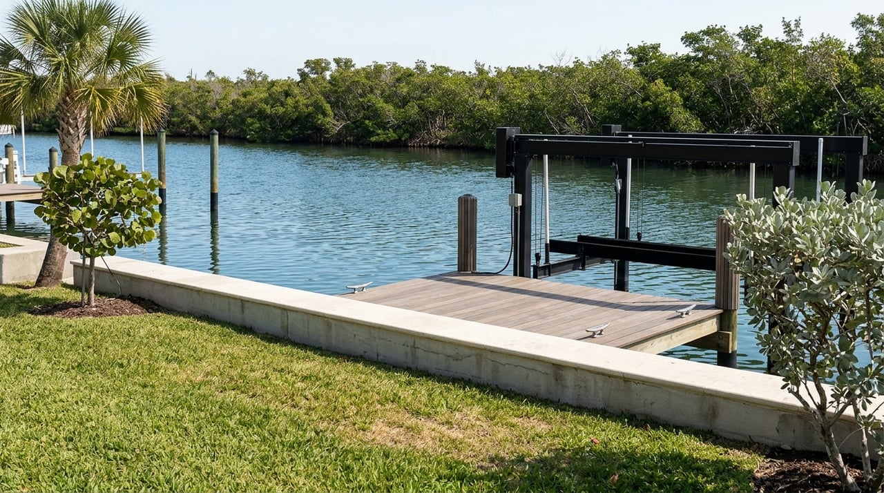
Dry storage and boatyards
Dry storage is popular with day-boat owners who want fast launches without keeping a boat in the water. On-land storage is another option if you prefer to trailer and handle more of your own logistics.
Dry stack basics
Dry stack storage uses vertical racks and forklifts or travelifts. Pros include quick launch and haul, reduced bottom maintenance, and weather protection. Consider size and weight limits, launch scheduling, and response time during peak season.
On-land and trailer storage
Open or covered yard storage can be budget-friendly if you already keep a trailer. You’ll manage launching yourself and plan around ramp parking and tides. Covered storage adds sun protection but usually costs more.
Questions to ask
- What is the max boat length, beam, and weight? What is the lift capacity?
- How long is the average launch turnaround and typical wait in season?
- What insurance is required? Are there liability waivers?
- Are short wet-slip layovers allowed after a haul? Any time limits?
- How are rates structured? Monthly or annual pricing, and charges per movement?
Fees, rules and safety
Local ramps and parks often charge per-launch or per-vehicle fees. Resident decals may reduce costs, and time-limited trailer parking is common in season. Arrive early on weekends and during winter months to avoid long waits.
- Navigation planning: Review NOAA nautical charts and NOAA tides and currents before each trip.
- Regulatory updates: Scan the U.S. Coast Guard Local Notice to Mariners for aid-to-navigation changes.
- Boater education and safety gear: Confirm PFD, fire extinguisher, and flare requirements with the Florida Fish and Wildlife Conservation Commission.
- Manatee and no-wake zones: See current maps and protections via the FWC manatee protection page. Slow zones are enforced and change by area.
Seasonal patterns
- Winter season, roughly November through April, brings higher ramp demand and fuller marinas. Book slips and storage early and expect longer launch queues.
- Summer is quieter but features strong afternoon sea breezes and storm activity. Plan morning departures and watch weather windows.
- Shallow bays can shoal at low tide. Build your route around favorable water levels and keep an eye on channel markers.
Quick choosing checklist
- Decide your priority: fastest launch with dry stack or on-water convenience with a wet slip.
- Confirm typical launch turnaround time and trailer parking where you plan to launch.
- Verify depth at the ramp approach and any low-tide restrictions for your draft.
- Ask about pump-out availability and the nearest fuel.
- Check seasonal pricing and reservation rules during winter high season.
- Confirm insurance and permit requirements before signing any marina or storage contract.
Work with a local guide
Choosing the right ramp, slip, or storage is easier when you have local insight on tides, bridge schedules, and seasonal demand. If you’re considering a home near these waterways, you’ll want to match the property’s boating access to your on-water plans. Our team pairs coastal market knowledge with practical boating know-how so you can enjoy more time on the water and less time troubleshooting logistics. Ready to align your home search with your boating lifestyle? Connect with The Real Estate Captains for friendly guidance and a free market valuation.
FAQs
What are the main waterways around Nokomis for small boats?
- Little Sarasota Bay, Roberts Bay, Lemon Bay, and the Intracoastal Waterway provide protected routes with Venice Inlet offering Gulf access when conditions allow.
Where can you find official ramp hours and fees near Nokomis?
- Check current details through Sarasota County Parks & Recreation and the City of Venice Parks & Recreation pages.
How do you check manatee and no-wake zones around Nokomis?
- Review current protections and maps on the FWC manatee protection page.
What should first-time Gulf boaters from Nokomis watch for?
- Plan around tides, inlet currents, afternoon sea breezes, and shoaling; confirm conditions with NOAA tides and currents and the USCG Local Notice to Mariners.
How do you choose between a wet slip and dry stack near Nokomis?
- Pick dry stack for quick launch and lower hull upkeep, or choose a wet slip for on-water convenience; compare rates, services, and access to fuel and pump-outs before committing.